
Gibbet Moor - Peak District Walk
Monday 30th October 2006
A misty walk across the rather featureless Gibbet Moor marked my return to the Peak District, although once the mist lifted there were some good views of the Edges. Looking at the colours of the ferns and trees there is no doubt now that autumn has arrived. This was another new walk for me and so I was relying on the directions in the book to point me towards the exit point from Harland Edge (which is Access Land), there wasn't one, I ended up scrambling over a wall to escape from the moor. Judging by the quite distinct footpath I followed from the point where I expected the exit to be I wasn't the only person caught out like this.
Start: Hell Bank Plantation (SK 2870 6800)
Route: Hell Bank Plantation - Gibbet Moor - Umberley Brook - Hob Hurst's House - Harland Edge - Hell Bank Plantation
Distance: 6.75 miles Ascent: 208 metres Time Taken: 4 hrs
Weather: Misty to start but clearing to leave high cloud and sunshine.
Pub Visited: None Ale Drunk: None

Harland Edge from the start of the walk.

Birchen Edge is lit up as the sun starts to break through the mist.

Umberley Brook at the point where I started to follow it.

Following the grouse huts made for easier navigation on the featureless Gibbet Moor.

The Stoop (probably 18th century) at Umberley Well which acted as a marker for people using the moors
many years ago. The hand points them in the direction of the route written above it.

Eaglestone Flat is lit up whilst Gibbet Moor remains in the shade.

Hob Hurst's House a bronze age burial site ............
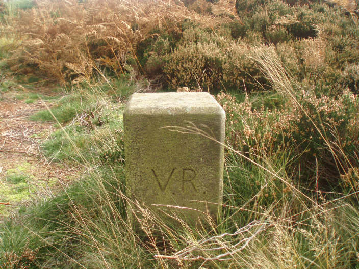
............... is one of the first monuments to be placed under the protection of the state in 1882
which is why these boundary markers have the initials V.R. for Victoria Regina.

Looking across to the area known as Rabbit Warren, from Harland Edge, with Bunkers Hill Wood to the right.

The trig point on Beeley Moor.

Harland Edge.

Looking across Harland Sick to Bunkers Hill Wood.
All pictures copyright © Peak Walker 2006-2023